Rumours of a goal too tantalising to ignore; a 120km trek in 7 days averaging over 4500m above sea level; no guide, no baggage transport and no backup; at least we had GPS, right, right?!?!
----------------------------------------------------
It all began a couple of weeks into our stay in Cusco. A simple comment on one of my Instagram posts from @nicholasbuer (https://i.instagram.com/nicholasbuer/):
"Find Vinicunca..."
We immediately started delving the internet but found very little, that is aside from a few photos. The photos were intriguing to say the least; a striped mountain apparently somewhere in the same region as Cusco. We really couldn't find much else. Well, there was tour company that passed by Vinucunca on a US$1450 (per person!) five day tour... Lord knows who's budget this fits, not ours!
I put it all out of mind but Bex's interest was far more piqued. I was busy silently berating Nick for planting the seed when he fired the second barrel (via Instagram again):
"Time dependant for sure... But that would be my challenge to you for Peru. It's off the beaten path, difficult to find but my word, its amazing."
Bex's mind was made up. I still had reservations, we simply had no information to go on.
We were busy with Spanish lessons each morning, but in the afternoons we trawled the internet for something we could work with. We were led, time and time again, to the same company offering the crazy priced trek, but eventually, back on Instagram, we found some basic information via linked blogs of those precious few contributers who had actually been there.
It was all still rumour rather than fact; misguided trips with 'guides' who claimed they knew the way and then didn't, groups getting hopelessly lost again and again, certainly no hint of maps, reputable guides or even coordinates of the elusive mountain. What we had was one simple suggestion we could use as a basis.
If we embarked on a known trekking route, the Ausangate circuit, we could veer off after a few days, maybe find Vinicunca and then head back and complete the trek. We checked Maps.Me (offline, open source GPS mapping app; don't leave home without it kids) and it had the main trail marked and ready for us to use, excellent! It was, of course, too much to ask to have Vinicunca or any connecting trails marked.
We partially closed this hole in the plan using a rather scientific process; scan around google earth looking for something that looked like it on satellite image (we had a rough approximation to start with, maybe a 20km² area...), grab the coordinates and punch them into Maps.Me. We grabbed screenshots of the satellite images for good measure, set a date to start (the following Monday) and we were pretty much all set! There was no guarantee of Vinicunca, but we could give it a go and retrace steps and just complete the circuit either way.
Leading up to the weekend we shopped for lightweight food (at least 7 days worth), charged all our tech (including a portable charger), bought a tent (we didn't think we'd need one this soon!) and camping gas, worked out where to get the bus (the start of the Ausangate trek was a good 3 hours away by road) and then on the Sunday afternoon packed ready for an early start Monday.
I must still have had 20kg to carry and my canteens weren't even all full. A 15 minute walk to the bus terminal was quite brutal on my back and shoulders, another 15 minutes to the correct terminal (oops!) didn't have me feeling too confident in the whole endeavour.
We arrived in the very quiet, small, town of Tinki some three hours later, stepped off the bus and the heavens opened. We staggered to an overhang outside a carpenters shop a mere 20m from the hut marking the start of the circuit and waited for the rain to abate.

Thankfully it brightened up considerably and 10 minutes later we were taking obligatory snaps with the trail sign next to the hut. We checked in with the park ranger in the hut, both parties surprised by the others presence, and we were off on the trail!


We were running incredibly late and got no where near the first 'offical' camp by nightfall. We'd trekked about three hours in intense heat up steep roads, were completely knackered and cursing our loads but we were happy. We threw up the tent by a disused stonewalled llama enclosure, consumed coffee and noodles and hit the sack straight afterwards.

Day 2 started with a long slog to reach the aforementioned official camp. We tramped straight through before midday, stopping only to filter water in the river running through. The entire north end of the Ausangate massif was now right ahead of us and we had a tough ascent to the first mountain pass of the circuit (the Arapa pass at 4800m) to deal with.

It's probably about now that I should mention another bit of information we had prior knowledge to. Aside from suggesting guides, most of what we had read also mentioned muleteers. It is apparently common to hire a mule and muleteer back in Tinki to carry all your gear for the trail.
We've done our share of multi-day treks with a full load, the muleteers are a considerable extra cost (well, compared to our outlay of £3 bus ticket and £3 park registration), you need to feed them and also possibly keep to their schedule. All things considered it seemed a bit if a luxury and anyway, with our planned side trip it seemed a lot of hassle to organise.
What we didn't appreciate was that, no matter how much acclimatization you may have done, high altitude ascents AND heavy loads will be tough work. By which I mean utterly and devastatingly brutal.
The 500m ascent to 4800m knocked us for six. By the halfway point we had lessened our strides to a point that each foot would barely pass the other. Our pace was nonexistent and we still had to stop, breath ragged and gasping, at 10-20m intervals.
We did, of course, reach the top. We also genuinely considered whether the task ahead was achievable. We had 3 more passes ahead, one at 5200m, and would not again descend below 4500m until the final day of the trek. This was all without the side trip in search of Vinicunca...
Oh well, we'd committed now.


The views from the pass were incredible. The descent was, thankfully, much easier and the views continued to dumbfound. The western side of the massif presented us with glaciers of outrageous size and length, all the day creaking and crumbling above ice blue lagoons. We encountered wild vicuña herds on the slopes and elusive viscachas among the boulder ridden valleys, all the while hawks and eagles wheeled above.


We were still tired beyond all previous experience. We set camp in the wild again, still out of sync with the 'standard' schedule but happy with progress and the absence of inclement weather.
Day 3. We started early, as ever, and battled over another high pass before arriving at the next offical camp, all before lunch. This marked the juncture at which we would veer off to where we hoped we would find Vinicunca. We ate lunch and headed straight off, this time without paths on our GPS, just pins for mountains along the way and for (what we hoped was a reasonably accurate approximation of) Vinicunca's location.
We set off south away from Ausangate, reached the end of the valley and headed west up the next valley. There were no more passes to contend with but the valley steadily rose to the base of two large mountains and our forced march (until our alloted finish time of 4pm) brought me to new levels of exhaustion.

Our moods were still positive at dinner however. We were making great progress and, with some creative pathfinding, we would hopefully pass across the shoulder of the mountains ahead and into the valley where Vinicunca might reside the following day.
My GPS (phone) was down to 25% battery so I grabbed the portable charger and connected it up. Nothing.
Odd. I definitely charged it before we left and we'd kept all electricals warm overnight. We tried every different cable and device we had and, with rising panic/dread/fear/annoyance, realised the charger was broken. Dead.
At least we had Bex's phone as backup. We powered that up to check the current battery life, except that was dead too. Balls. We had just my phone with 25% life left and, best estimate 3 to 5 days trekking ahead.
We were quite despondent by this point. We had relied on the GPS a lot, much more than we had expected. The paths on the circuit had not been very obvious, disuse meant they were not well worn and very often farmer and llama paths were much clearer (and thus easily and mistakenly taken).
We hit the sack realising that, not only might we not find Vinicunca, but we may also very well have to retrace our previous trail and thus not even complete the Ausangate circuit. I hesitantly switched off the phone, silently praying it would hold the majority of its charge until needed once more.
Day 4. We still had hope. We still had plenty of food, we still had fine weather (well, the nights had all been freezing, but the days were fine!) and, although aching from head to toe, we were healthy and whole.
We broke camp and trudged ever higher to the valley's end. We were certain of a pass being found on the shoulder of the snowclad behemoth ahead (Mt. Wasaqucha) and, as we slowly approached, the passing of animal and person were clearly visible on the path.
This brought with it a new sense of apprehension. What we might (or might not) see from the pass would determine the fate of the side trip and therefore our ultimate goal.
We held our breaths as we crested the pass and, beyond my greatest hopes, we glimpsed Vinicunca in the far distance. Yes, it was across an entire valley and appeared to sit on a high pass leading to yet another valley, but we could actually SEE it and could plot a path to it!


Some considerable time and effort later we reached the opposite side of the valley. Turns out Nick was right; my word, it was amazing! For such an incredible natural wonder to go mostly unnoticed seems impossible. Not that we were complaining, we hadn't seen another soul for a whole day and so Vinicunca was all ours... for as long as we could stand the biting wind, which wasn't quite as long as we might have liked.


The freezing winds pounded us up on the pass and in the east heavy storms seemed to to be rolling around ominously. We tore ourselves away from Vinicunca and headed to a site we'd used for lunch and set camp early; with two passes climbed we'd not be able to return to the valley of the previous night that same day. The weather caught us, but not full force, exhaustion drove us to sleep even with rain and sleet lashing the tent.


Day 5. Snow and frost greeted us early morning, a cold but welcome source of water for our morning coffee and porridge. A day without incident nor excitement, we headed all the way back to the official campsite where we had left the Ausangate circuit. We spent the day forcing ourselves to deliberate the elephant in the room; what would we do back on the trail with GPS power in only very short supply. Our moods slumped as we set camp early in rain and wind, none of which improved as night rolled in.
Day 6. Bex's relentless determination has clearly started to rub off on me, but 'safety dad' has to have a say in pursuits of this nature. We would go on, even if we now only had 15% GPS battery. But we would have to ration food enough for a full retracing of steps in case we lost the path and could not continue forward.
We crossed a huge pass before 9am and were instantly shocked by the enormity of the next valley. The distances down and across were incredible and the only visible path seemed to drop deep down and then out east. We followed steeply down with no other options available to us.
We soon felt uneasy and had to resort to GPS far earlier than we hoped. We kicked ourselves for wasting battery when it confirmed we were on course, but also took comfort in that same knowledge. We briefly took time to compare the outlined path with the new landscape presented to us before powering down at 6%.
The day was, for the most part, bright and clear. With the walking now either downhill or flat, we made great progress, and at around 2pm stumbled across an unmarked (on anything we'd seen) but official campsite. If nothing else it confirmed we were still on the right path. It had only a half finished hut but seemed to have been used rather a lot. Rubbish and excrement, both mule and human, littered the site. We passed on through, it was basically a dump and far too early to stop anyway.
As we approached a dwelling at a spilt in the valley the trail became obscured by those of farmer and animal. We asked the owners "donde camino? " (rubbish but functional Spanish) and headed off to the right in a curve around the farm, as we thought they had indicated.
You have already guessed where this is going I'm sure.
Around 4pm we started looking for spots to camp, but for 2 hours previous were also looking for the next mountain pass. Nothing seemed to present itself on the ridges ahead or to either side, in fact we were almost convinced that the path we had been on might end at another llama farm, now visible just up ahead.
Up on the ridge a llama herdess appeared and started leading her flock down to the farm. I left Bex with our packs and climbed the incredibly steep rise to intersect her path. Upon closer inspection I realised she couldn't have been older than 8, and she certainly didn't expect to see us, let alone want to converse with me.
"donde camino Ausangate?" She just looked scared.
I needed backup. Bex forced herself up the slope, fully equipped with big smiles and sweets. The little girl relaxed a tad and when the question was repeated she pointed back down the valley the way we had come. This couldn't be right. The circuit is only really navigated in the anticlockwise direction we were following, and we had passed an official camp only 2 hours previous.
We pleaded her to wait while we consulted the map on my camera (yes, that's right folks, we were now relying on a photo of the trail sign outside the park hut from day 1). The nearest named landmark available was the village at the end of the trail, we asked where that might be and she pointed to a bunch of ragged peaks far beyond the rise which we had half climbed.

We returned to our bags and deliberated what to do next. The light was failing, so we had to set camp soon, however before that I would climb the rise between this and the next valley, assess the lie of the land and report back. Even without my pack it turned out to be quite an undertaking. 9 hours trekking with a full pack at altitude hurts, I can't emphasise this enough.
Hills and mountains often kid you into guessing their true height. You head to a rise only to find another more distant 'summit' ahead. In this instance it happened four times. Somewhat broken I did reach the top, and it was spectacular! Not that I could fully appreciate it, I scanned the valley and peaks and thought I might have seen a slight curve away and a high path at the end of the valley.
It was roughly where the girl had pointed, but nothing solid to go by. It certainly didn't improve our mood much either, only one thing for it...
We switched on the phone.
6% searching for location.
5% searching for location.
4% searching for location.
(arrrrgggggghhhhhhhhh!)
Bex had an idea, she took control. Somewhere in a world of wistful thinking she'd heard that warming batteries up could not only preserve, but recover their charge.
I was too tired to dismiss such whimsy and passed the phone over to her.
She whipped out the battery and chucked it in her bra.
A few minutes later we reassembled the phone and powered it up.
17% searching for location - "shit the bed!"
And then it located us too! We were 1km south (as the crow flies...) from the path, we basically needed to climb the ridge (again, but with full packs of course ), drop down in to the basin, cross it and locate the true path. That's a plan in our books. Tent up, food, sleep.


Day 7. A single kilometer can sometimes seem an awfully long way. The climb up was way too steep for full packs, the climb down involved a heavily bouldered scramble, and the basin crossing was a mossy pathless marshland.
Determination can get you a long way though. We continued on, and staggered up the opposite valley wall until we found 'the' path. We followed the trail endlessly up and around the valley end before clearing a high pass in a snowstorm and then descending once more.


Altitude's grip on us begun to lessen, the sky cleared and the paths broadened. We passed one campsite and almost immediately staggered into another. We found people, tourists in fact (we'd come across only a few farmers over the previous six days).
They were heading out on a nearby summit attempt but informed us that, amazingly, we were 3 hours away from the trail end. We were stunned, we thought we had another pass and another night camping ahead.
We ploughed on, starting to bake in the afternoon sun. By our reckoning we could make the village (that was our goal) by 3pm and then grab a taxi back to Tinki.
We arrived as planned but there wasn't a taxi to found. The road signs read 12km to Tinki, we had 3 hours till nightfall and we'd be dammed if we're weren't staying in a hostel with a cold beer that night.
It was our longest day, 11 hours and 30km (with a 4800m pass in driving sleet and snow). The hostel had no hot water or showers, our room had a window missing and door with neither lock or handle. We ate every remaining morsel of food, washed it down with cold beer and slept under blankets as heavy and itchy as old carpets.
It was amazing.
It had all been amazing. We'd pushed ourselves far beyond the limits which I ever thought I could reach and then some. I'd seen sights I honestly rate above all overs I've seen on my travels. To top it all off we found Vinicunca.
I thank you Nick (though I owe you a challenge).


It all began a couple of weeks into our stay in Cusco. A simple comment on one of my Instagram posts from @nicholasbuer (https://i.instagram.com/nicholasbuer/):
"Find Vinicunca..."
We immediately started delving the internet but found very little, that is aside from a few photos. The photos were intriguing to say the least; a striped mountain apparently somewhere in the same region as Cusco. We really couldn't find much else. Well, there was tour company that passed by Vinucunca on a US$1450 (per person!) five day tour... Lord knows who's budget this fits, not ours!
I put it all out of mind but Bex's interest was far more piqued. I was busy silently berating Nick for planting the seed when he fired the second barrel (via Instagram again):
"Time dependant for sure... But that would be my challenge to you for Peru. It's off the beaten path, difficult to find but my word, its amazing."
Bex's mind was made up. I still had reservations, we simply had no information to go on.
We were busy with Spanish lessons each morning, but in the afternoons we trawled the internet for something we could work with. We were led, time and time again, to the same company offering the crazy priced trek, but eventually, back on Instagram, we found some basic information via linked blogs of those precious few contributers who had actually been there.
It was all still rumour rather than fact; misguided trips with 'guides' who claimed they knew the way and then didn't, groups getting hopelessly lost again and again, certainly no hint of maps, reputable guides or even coordinates of the elusive mountain. What we had was one simple suggestion we could use as a basis.
If we embarked on a known trekking route, the Ausangate circuit, we could veer off after a few days, maybe find Vinicunca and then head back and complete the trek. We checked Maps.Me (offline, open source GPS mapping app; don't leave home without it kids) and it had the main trail marked and ready for us to use, excellent! It was, of course, too much to ask to have Vinicunca or any connecting trails marked.
We partially closed this hole in the plan using a rather scientific process; scan around google earth looking for something that looked like it on satellite image (we had a rough approximation to start with, maybe a 20km² area...), grab the coordinates and punch them into Maps.Me. We grabbed screenshots of the satellite images for good measure, set a date to start (the following Monday) and we were pretty much all set! There was no guarantee of Vinicunca, but we could give it a go and retrace steps and just complete the circuit either way.
Leading up to the weekend we shopped for lightweight food (at least 7 days worth), charged all our tech (including a portable charger), bought a tent (we didn't think we'd need one this soon!) and camping gas, worked out where to get the bus (the start of the Ausangate trek was a good 3 hours away by road) and then on the Sunday afternoon packed ready for an early start Monday.
I must still have had 20kg to carry and my canteens weren't even all full. A 15 minute walk to the bus terminal was quite brutal on my back and shoulders, another 15 minutes to the correct terminal (oops!) didn't have me feeling too confident in the whole endeavour.
We arrived in the very quiet, small, town of Tinki some three hours later, stepped off the bus and the heavens opened. We staggered to an overhang outside a carpenters shop a mere 20m from the hut marking the start of the circuit and waited for the rain to abate.

Thankfully it brightened up considerably and 10 minutes later we were taking obligatory snaps with the trail sign next to the hut. We checked in with the park ranger in the hut, both parties surprised by the others presence, and we were off on the trail!


We were running incredibly late and got no where near the first 'offical' camp by nightfall. We'd trekked about three hours in intense heat up steep roads, were completely knackered and cursing our loads but we were happy. We threw up the tent by a disused stonewalled llama enclosure, consumed coffee and noodles and hit the sack straight afterwards.

Day 2 started with a long slog to reach the aforementioned official camp. We tramped straight through before midday, stopping only to filter water in the river running through. The entire north end of the Ausangate massif was now right ahead of us and we had a tough ascent to the first mountain pass of the circuit (the Arapa pass at 4800m) to deal with.

It's probably about now that I should mention another bit of information we had prior knowledge to. Aside from suggesting guides, most of what we had read also mentioned muleteers. It is apparently common to hire a mule and muleteer back in Tinki to carry all your gear for the trail.
We've done our share of multi-day treks with a full load, the muleteers are a considerable extra cost (well, compared to our outlay of £3 bus ticket and £3 park registration), you need to feed them and also possibly keep to their schedule. All things considered it seemed a bit if a luxury and anyway, with our planned side trip it seemed a lot of hassle to organise.
What we didn't appreciate was that, no matter how much acclimatization you may have done, high altitude ascents AND heavy loads will be tough work. By which I mean utterly and devastatingly brutal.
The 500m ascent to 4800m knocked us for six. By the halfway point we had lessened our strides to a point that each foot would barely pass the other. Our pace was nonexistent and we still had to stop, breath ragged and gasping, at 10-20m intervals.
We did, of course, reach the top. We also genuinely considered whether the task ahead was achievable. We had 3 more passes ahead, one at 5200m, and would not again descend below 4500m until the final day of the trek. This was all without the side trip in search of Vinicunca...
Oh well, we'd committed now.

Hellish... But incredible


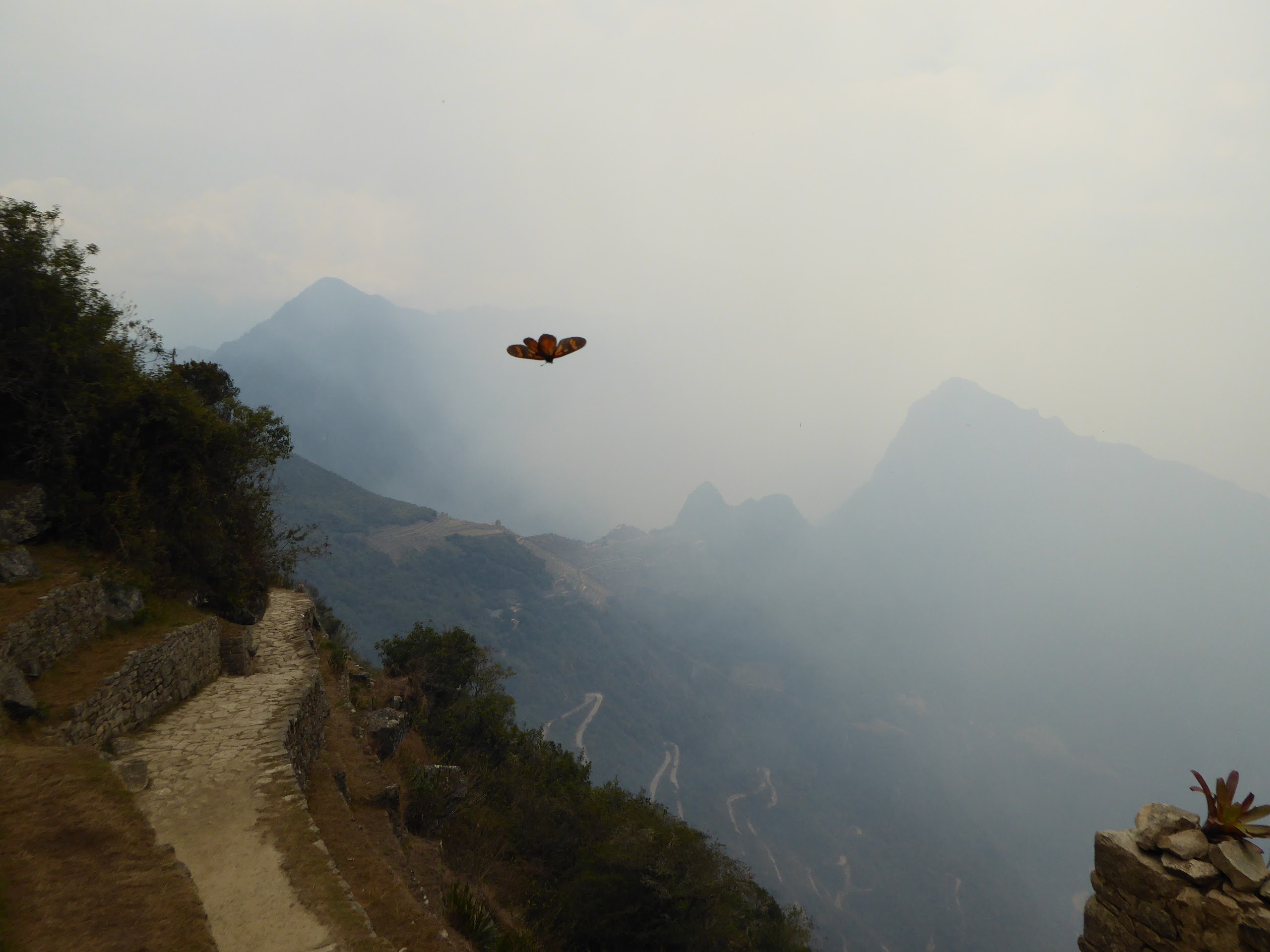
The views from the pass were incredible. The descent was, thankfully, much easier and the views continued to dumbfound. The western side of the massif presented us with glaciers of outrageous size and length, all the day creaking and crumbling above ice blue lagoons. We encountered wild vicuña herds on the slopes and elusive viscachas among the boulder ridden valleys, all the while hawks and eagles wheeled above.


Vicuna (like llamas, but wild and rare)

Viscachas (rodents the size of domestic cats, related to chinchillas)
We were still tired beyond all previous experience. We set camp in the wild again, still out of sync with the 'standard' schedule but happy with progress and the absence of inclement weather.
Day 3. We started early, as ever, and battled over another high pass before arriving at the next offical camp, all before lunch. This marked the juncture at which we would veer off to where we hoped we would find Vinicunca. We ate lunch and headed straight off, this time without paths on our GPS, just pins for mountains along the way and for (what we hoped was a reasonably accurate approximation of) Vinicunca's location.
We set off south away from Ausangate, reached the end of the valley and headed west up the next valley. There were no more passes to contend with but the valley steadily rose to the base of two large mountains and our forced march (until our alloted finish time of 4pm) brought me to new levels of exhaustion.

Day 3 camp
Our moods were still positive at dinner however. We were making great progress and, with some creative pathfinding, we would hopefully pass across the shoulder of the mountains ahead and into the valley where Vinicunca might reside the following day.
My GPS (phone) was down to 25% battery so I grabbed the portable charger and connected it up. Nothing.
Odd. I definitely charged it before we left and we'd kept all electricals warm overnight. We tried every different cable and device we had and, with rising panic/dread/fear/annoyance, realised the charger was broken. Dead.
At least we had Bex's phone as backup. We powered that up to check the current battery life, except that was dead too. Balls. We had just my phone with 25% life left and, best estimate 3 to 5 days trekking ahead.
We were quite despondent by this point. We had relied on the GPS a lot, much more than we had expected. The paths on the circuit had not been very obvious, disuse meant they were not well worn and very often farmer and llama paths were much clearer (and thus easily and mistakenly taken).
We hit the sack realising that, not only might we not find Vinicunca, but we may also very well have to retrace our previous trail and thus not even complete the Ausangate circuit. I hesitantly switched off the phone, silently praying it would hold the majority of its charge until needed once more.
Day 4. We still had hope. We still had plenty of food, we still had fine weather (well, the nights had all been freezing, but the days were fine!) and, although aching from head to toe, we were healthy and whole.
We broke camp and trudged ever higher to the valley's end. We were certain of a pass being found on the shoulder of the snowclad behemoth ahead (Mt. Wasaqucha) and, as we slowly approached, the passing of animal and person were clearly visible on the path.
This brought with it a new sense of apprehension. What we might (or might not) see from the pass would determine the fate of the side trip and therefore our ultimate goal.
We held our breaths as we crested the pass and, beyond my greatest hopes, we glimpsed Vinicunca in the far distance. Yes, it was across an entire valley and appeared to sit on a high pass leading to yet another valley, but we could actually SEE it and could plot a path to it!

Almost to the pass

Our goal in sight (trust me!)
Some considerable time and effort later we reached the opposite side of the valley. Turns out Nick was right; my word, it was amazing! For such an incredible natural wonder to go mostly unnoticed seems impossible. Not that we were complaining, we hadn't seen another soul for a whole day and so Vinicunca was all ours... for as long as we could stand the biting wind, which wasn't quite as long as we might have liked.


We made it!
The freezing winds pounded us up on the pass and in the east heavy storms seemed to to be rolling around ominously. We tore ourselves away from Vinicunca and headed to a site we'd used for lunch and set camp early; with two passes climbed we'd not be able to return to the valley of the previous night that same day. The weather caught us, but not full force, exhaustion drove us to sleep even with rain and sleet lashing the tent.

Camp early afternoon...

...and the morning after
Day 5. Snow and frost greeted us early morning, a cold but welcome source of water for our morning coffee and porridge. A day without incident nor excitement, we headed all the way back to the official campsite where we had left the Ausangate circuit. We spent the day forcing ourselves to deliberate the elephant in the room; what would we do back on the trail with GPS power in only very short supply. Our moods slumped as we set camp early in rain and wind, none of which improved as night rolled in.
Day 6. Bex's relentless determination has clearly started to rub off on me, but 'safety dad' has to have a say in pursuits of this nature. We would go on, even if we now only had 15% GPS battery. But we would have to ration food enough for a full retracing of steps in case we lost the path and could not continue forward.
We crossed a huge pass before 9am and were instantly shocked by the enormity of the next valley. The distances down and across were incredible and the only visible path seemed to drop deep down and then out east. We followed steeply down with no other options available to us.
We soon felt uneasy and had to resort to GPS far earlier than we hoped. We kicked ourselves for wasting battery when it confirmed we were on course, but also took comfort in that same knowledge. We briefly took time to compare the outlined path with the new landscape presented to us before powering down at 6%.
The day was, for the most part, bright and clear. With the walking now either downhill or flat, we made great progress, and at around 2pm stumbled across an unmarked (on anything we'd seen) but official campsite. If nothing else it confirmed we were still on the right path. It had only a half finished hut but seemed to have been used rather a lot. Rubbish and excrement, both mule and human, littered the site. We passed on through, it was basically a dump and far too early to stop anyway.
As we approached a dwelling at a spilt in the valley the trail became obscured by those of farmer and animal. We asked the owners "donde camino? " (rubbish but functional Spanish) and headed off to the right in a curve around the farm, as we thought they had indicated.
You have already guessed where this is going I'm sure.
Around 4pm we started looking for spots to camp, but for 2 hours previous were also looking for the next mountain pass. Nothing seemed to present itself on the ridges ahead or to either side, in fact we were almost convinced that the path we had been on might end at another llama farm, now visible just up ahead.
Up on the ridge a llama herdess appeared and started leading her flock down to the farm. I left Bex with our packs and climbed the incredibly steep rise to intersect her path. Upon closer inspection I realised she couldn't have been older than 8, and she certainly didn't expect to see us, let alone want to converse with me.
"donde camino Ausangate?" She just looked scared.
I needed backup. Bex forced herself up the slope, fully equipped with big smiles and sweets. The little girl relaxed a tad and when the question was repeated she pointed back down the valley the way we had come. This couldn't be right. The circuit is only really navigated in the anticlockwise direction we were following, and we had passed an official camp only 2 hours previous.
We pleaded her to wait while we consulted the map on my camera (yes, that's right folks, we were now relying on a photo of the trail sign outside the park hut from day 1). The nearest named landmark available was the village at the end of the trail, we asked where that might be and she pointed to a bunch of ragged peaks far beyond the rise which we had half climbed.

Full extent of navigation aids...
We returned to our bags and deliberated what to do next. The light was failing, so we had to set camp soon, however before that I would climb the rise between this and the next valley, assess the lie of the land and report back. Even without my pack it turned out to be quite an undertaking. 9 hours trekking with a full pack at altitude hurts, I can't emphasise this enough.
Hills and mountains often kid you into guessing their true height. You head to a rise only to find another more distant 'summit' ahead. In this instance it happened four times. Somewhat broken I did reach the top, and it was spectacular! Not that I could fully appreciate it, I scanned the valley and peaks and thought I might have seen a slight curve away and a high path at the end of the valley.
It was roughly where the girl had pointed, but nothing solid to go by. It certainly didn't improve our mood much either, only one thing for it...
We switched on the phone.
6% searching for location.
5% searching for location.
4% searching for location.
(arrrrgggggghhhhhhhhh!)
Bex had an idea, she took control. Somewhere in a world of wistful thinking she'd heard that warming batteries up could not only preserve, but recover their charge.
I was too tired to dismiss such whimsy and passed the phone over to her.
She whipped out the battery and chucked it in her bra.
A few minutes later we reassembled the phone and powered it up.
17% searching for location - "shit the bed!"
And then it located us too! We were 1km south (as the crow flies...) from the path, we basically needed to climb the ridge (again, but with full packs of course ), drop down in to the basin, cross it and locate the true path. That's a plan in our books. Tent up, food, sleep.


Kind of lost... But sure was pretty!
Day 7. A single kilometer can sometimes seem an awfully long way. The climb up was way too steep for full packs, the climb down involved a heavily bouldered scramble, and the basin crossing was a mossy pathless marshland.
Determination can get you a long way though. We continued on, and staggered up the opposite valley wall until we found 'the' path. We followed the trail endlessly up and around the valley end before clearing a high pass in a snowstorm and then descending once more.


Altitude's grip on us begun to lessen, the sky cleared and the paths broadened. We passed one campsite and almost immediately staggered into another. We found people, tourists in fact (we'd come across only a few farmers over the previous six days).
They were heading out on a nearby summit attempt but informed us that, amazingly, we were 3 hours away from the trail end. We were stunned, we thought we had another pass and another night camping ahead.
We ploughed on, starting to bake in the afternoon sun. By our reckoning we could make the village (that was our goal) by 3pm and then grab a taxi back to Tinki.
We arrived as planned but there wasn't a taxi to found. The road signs read 12km to Tinki, we had 3 hours till nightfall and we'd be dammed if we're weren't staying in a hostel with a cold beer that night.
It was our longest day, 11 hours and 30km (with a 4800m pass in driving sleet and snow). The hostel had no hot water or showers, our room had a window missing and door with neither lock or handle. We ate every remaining morsel of food, washed it down with cold beer and slept under blankets as heavy and itchy as old carpets.
It was amazing.
It had all been amazing. We'd pushed ourselves far beyond the limits which I ever thought I could reach and then some. I'd seen sights I honestly rate above all overs I've seen on my travels. To top it all off we found Vinicunca.
I thank you Nick (though I owe you a challenge).


The end.